
Heat output from the south polar region of Saturn's moon Enceladus is much greater than was previously thought possible, according to a new analysis of data collected by NASA's Cassini spacecraft. The study was published in the Journal of Geophysical Research on March 4. Data from Cassini's composite infrared spectrometer of Enceladus' south polar terrain, which is marked by linear fissures, indicate that the internal heat-generated power is about 15.8 gigawatts, approximately 2.6 times the power output of all the hot springs in the Yellowstone region, or comparable to 20 coal-fueled power stations. This is more than an order of magnitude higher than scientists had predicted, according to Carly Howett, the lead author of study, who is a postdoctoral researcher at Southwest Research Institute in Boulder, Colo., and a composite infrared spectrometer science team member.
"The mechanism capable of producing the much higher observed internal power remains a mystery and challenges the currently proposed models of long-term heat production," said Howett. It has been known since 2005 that Enceladus' south polar terrain is geologically active and the activity is centered on four roughly parallel linear trenches, 130 kilometers (80 miles) long and about 2 kilometers (1 mile) wide, informally known as the "tiger stripes." Cassini also found that these fissures eject great plumes of ice particles and water vapor continually into space. These trenches have elevated temperatures due to heat leaking out of Enceladus' interior.
A 2007 study predicted the internal heat of Enceladus, if principally generated by tidal forces arising from the orbital resonance between Enceladus and another moon, Dione, could be no greater than 1.1 gigawatts averaged over the long term. Heating from natural radioactivity inside Enceladus would add another 0.3 gigawatts. The latest analysis, which also involved the composite infrared spectrometer team members John Spencer at Southwest Research Institute, and John Pearl and Marcia Segura at NASA's Goddard Space Flight Center in Greenbelt, Md., uses observations taken in 2008, which cover the entire south polar terrain. They constrained Enceladus' surface temperatures to determine the region's surprisingly high output.

NASA's Glory spacecraft is scheduled for launch on Friday, March 4. Technical issues with ground support equipment for the Taurus XL launch vehicle led to the scrub of the original Feb. 23 launch attempt. Those issues have been resolved. The liftoff from Vandenberg Air Force Base in California is targeted for 5:09:43 a.m. EST, in the middle of a 48-second launch window. Spacecraft separation occurs 13 minutes after launch. Coverage of the countdown on the Glory launch blog and on NASA TV will begin on launch day at 3:30 a.m. EST. Data from the Glory mission will allow scientists to better understand how the sun and tiny atmospheric particles called aerosols affect Earth's climate.
Both aerosols and solar energy influence the planet's energy budget the amount of energy entering and exiting Earth's atmosphere. An accurate measurement of these impacts is important in order to anticipate future changes to our climate and how they may affect human life. Project management for Glory is the responsibility of NASA's Goddard Space Flight Center in Greenbelt, Md. The launch management for the mission is the responsibility of NASA's Launch Services Program at the Kennedy Space Center in Florida. Orbital Sciences Corp. of Dulles, Va., is the launch service provider to Kennedy of the four-stage Taurus XL rocket and is also builder of the Glory satellite for Goddard.
 In communities all across the U.S., travelers that went to the moon and back with the Apollo 14 mission are living out their quiet lives. The whereabouts of more than 50 are known. Many, now aging, reside in prime retirement locales: Florida, Arizona and California. A few are in the Washington, D.C., area. Hundreds more are out there or at least, they were. And Dave Williams of NASA's Goddard Space Flight Center in Greenbelt, Md., wants to find them before it's too late. The voyagers in question are not astronauts. They're "moon trees" redwood, loblolly pine, sycamore, Douglas fir, and sweetgum trees sprouted from seeds that astronaut Stuart Roosa took to the moon and back 40 years ago.
"Hundreds of moon trees were distributed as seedlings," says Williams, "but we don't have systematic records showing where they all went." And though some of the trees are long-lived species expected to live hundreds or thousands of years, others have started to succumb to the pressures of old age, severe weather and disease. At least a dozen have died, including the loblolly pine at the White House and a New Orleans pine that was damaged by Hurricane Katrina and later removed. To capture the vanishing historical record, Williams, a curator at the National Space Science Data Center, has been tracking down the trees, dead or alive.
His sleuthing started in 1996, prompted by an email from a third-grade teacher, Joan Goble, asking about a tree at the Camp Koch Girl Scout Camp in Cannelton, Ind. A simple sign nearby read "moon tree." "At the time, I had never heard of moon trees," Williams says. "The sign had a few clues, so I sent a message to the NASA history office and found more bits and pieces on the web. Then I got in touch with Stan Krugman and got more of the story." Krugman had been the U.S. Department of Agriculture Forest Service's staff director for forest genetics research in 1971. He had given the seeds to Roosa, who stowed them in his personal gear for the Apollo 14 mission. The seeds were symbolic for Roosa because he had fought wildfires as a smoke jumper before becoming an Air Force test pilot and then an astronaut.

NASA has awarded a sole source contract to Lockheed Martin Space Systems Company (LMSSC) of Greenbelt, Md., for Systems Engineering for In-Space Servicing (SEISS). This cost-plus-fixed-fee, 18-month contract has a value of $31.2 million. LMSSC will provide systems and discipline engineering support to develop and execute two demonstrations to test and verify new robotic servicing capabilities using the Dextre robot aboard the International Space Station. The Canadian Space Agency's Special Purpose Dexterous Manipulator, or Dextre, is a two-armed robotic system designed to perform intricate maintenance and servicing tasks, which previously would have required spacewalks.
The first demonstration will use a customized payload task box, Dextre and specialized tools to robotically demonstrate refueling and repair tasks in orbit. Tasks will include locating, accessing and uncapping valves and transferring simulated liquid fuel. During the second demonstration, Dextre will test and evaluate a variety of tools, sensors and instruments to support autonomous rendezvous and capture capabilities for orbiting spacecraft systems. NASA's Goddard Space Flight Center in Greenbelt, Md., is developing both demonstration payloads. These demonstrations are intended to increase NASA's technical capability to conduct robotic in-space servicing. The contract encompasses requirements definition and verification, hardware design, support of flight and ground hardware/software development, and mission planning support.
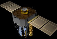
As people on Earth celebrate the holidays and prepare to ring in the New Year, an ESA/NASA spacecraft has quietly reached its own milestone: on December 26, the Solar and Heliospheric Observatory (SOHO) discovered its 2000th comet. Drawing on help from citizen scientists around the world, SOHO has become the single greatest comet finder of all time. This is all the more impressive since SOHO was not specifically designed to find comets, but to monitor the sun. "Since it launched on December 2, 1995 to observe the sun, SOHO has more than doubled the number of comets for which orbits have been determined over the last three hundred years," says Joe Gurman, the U.S. project scientist for SOHO at NASA's Goddard Space Flight Center in Greenbelt, Md.
Of course, it is not SOHO itself that discovers the comets that is the province of the dozens of amateur astronomer volunteers who daily pore over the fuzzy lights dancing across the pictures produced by SOHO's LASCO (or Large Angle and Spectrometric Coronagraph) cameras. Over 70 people representing 18 different countries have helped spot comets over the last 15 years by searching through the publicly available SOHO images online. The 1999th and 2000th comet were both discovered on December 26 by Michal Kusiak, an astronomy student at Jagiellonian University in Krakow, Poland. Kusiak found his first SOHO comet in November 2007 and has since found more than 100.
"There are a lot of people who do it," says Karl Battams who has been in charge of running the SOHO comet-sighting website since 2003 for the Naval Research Lab in Washington, where he also does computer processing for LASCO. "They do it for free, they're extremely thorough, and if it wasn't for these people, most of this stuff would never see the light of day." Battams receives reports from people who think that one of the spots in SOHO's LASCO images looks to be the correct size and brightness and headed for the sun characteristics typical of the comets SOHO finds. He confirms the finding, gives each comet an unofficial number, and then sends the information off to the Minor Planet Center in Cambridge, Mass, which categorizes small astronomical bodies and their orbits.

Travelers over the long holiday weekend can count on one Christmas present: great satellite data from the GOES series of satellites to help them in their travels. Data from the GOES-13 and GOES-11 satellites were used to create a full image of the continental U.S. on Dec. 23 at 1145 UTC (6:45 a.m. EST) as travelers make their way across the country to their holiday destinations. GOES-13 and GOES-11 are the Geostationary Operational Environmental Satellites that monitor the nation's weather for the U.S. GOES satellites are operated by NOAA, and images and animations are created at the NASA GOES Project at NASA's Goddard Space Flight Center in Greenbelt, Md.
The GOES-11 satellite is stationary over the western U.S. and provides imagery of that half of the country in addition to visible and infrared images of the eastern and central Pacific Oceans. GOES-13 covers the eastern half of the nation and the Atlantic Ocean. The holiday travel image combines data from both of these satellites. The image showed a large area clouds from the U.S. southwest stretching north. Those clouds are associated with a low pressure area currently over Colorado. The storm system affecting the Southwest is forecast to move eastward and slide off the coast. It could then track north along the coast and bring some heavy winter weather to coastal areas from the Carolinas northward. Travel could be affected particularly Sunday and Monday along the U.S. East coast from this storm system.
NOAA will be tracking the storm and issuing forecasts over the weekend as the low moves. On Thursday, Dec. 23, the GOES image showed clouds over eastern New England that are associated with a low already out to sea and taking rain with it. In the upper Midwest and Southern Plains states a short wave of energy is going through the region. Some snow showers are forecast for Thursday night, Friday and Saturday in Milwaukee, Wisconsin. Snow is forecast in Kansas City, Missouri on Friday, while some sun and flurries are expected on Christmas day. Areas of the Midwest should also be on guard for freezing rain, sleet and snow over the weekend.

An international team of scientists studying remnants of an asteroid that crashed into the Nubian Desert in October 2008 discovered it contained at least 10 different types of meteorites. Some of them contained chemicals that form the building blocks of life on Earth, and those chemicals were spread through all parts of the asteroid by collisions. Chemists at Stanford University found that different meteorite types share the same distinct fingerprint of polycyclic aromatic hydrocarbons (PAHs). These complex organic molecules are distributed throughout the galaxy and form on Earth from incomplete combustion.
A research team from NASA's Goddard Space Flight Center in Greenbelt, Md., found amino acids in strongly heated fragments of the asteroid, where all such molecules should have been destroyed. Both PAHs and amino acids are considered building blocks of life. Before landing on Earth, the 13-foot asteroid was detected by a telescope from the NASA-sponsored Catalina Sky Survey based at the University of Arizona in Tucson. Hours prior to its demise, astronomers and scientists around the world tracked and scanned the asteroid. It was the first time a celestial object was observed prior to entering Earth's atmosphere.
NASA's Jet Propulsion Laboratory in Pasadena, Calif., created a search grid and impact target area. The data helped Peter Jenniskens, an astronomer at NASA's Ames Research Center in Moffett Field, Calif., and the SETI Institute of Mountain View, Calif., guide a recovery team from the University of Khartoum in Sudan to search the desert landscape. During four expeditions, approximately 150 students recovered nearly 600 meteorite fragments weighing a total of more than 23 pounds. "Right from the start, the students were surprised to find so much diversity in meteorite texture and hue," said Muawia Shaddad, an astronomer at the University of Khartoum, who led the search effort. "We estimate the asteroid initially weighed about 59 tons, of which about 86 pounds survived the explosion high in the atmosphere."

Black is black, right? Not so, according to a team of NASA engineers now developing a blacker-than pitch material that will help scientists gather hard-to-obtain scientific measurements or observe currently unseen astronomical objects, like Earth-sized planets in orbit around other stars. The nanotech-based material now being developed by a team of 10 technologists at the NASA Goddard Space Flight Center in Greenbelt, Md., is a thin coating of multi-walled carbon nanotubes tiny hollow tubes made of pure carbon about 10,000 times thinner than a strand of human hair.
Nanotubes have a multitude of potential uses, particularly in electronics and advanced materials due to their unique electrical properties and extraordinary strength. But in this application, NASA is interested in using the technology to help suppress errant light that has a funny way of ricocheting off instrument components and contaminating measurements. "This is a technology that offers a lot of payback," said engineer Leroy Sparr, who is assessing its effectiveness on the Ocean Radiometer for Carbon Assessment (ORCA), a next-generation instrument that is designed to measure marine photosynthesis. "It's about 10 times better than black paint" typically used by NASA instrument designers to suppress stray light, he said.
The technology works because of its super-absorption abilities. The nanotubes themselves are packed vertically much like a shag rug. The tiny gaps between the tubes absorb 99.5 percent of the light that hits them. In other words, very few photons are reflected off the carbon-nanotube coating, which means that stray light cannot reflect off surfaces and interfere with the light that scientists actually want to measure. The human eye sees the material as black because only a small fraction of light reflects off the material.

What are you doing for the holidays this winter? Spending time with family and friends? More than a dozen Near Earth Network engineers and support personnel from NASA’s Goddard Space Flight Center in Greenbelt, Md., and Wallops Flight Facility in Va., will be packing their bags and spending their holidays far away from their families at McMurdo Station, Antarctica, for the austral summer. McMurdo Station is one of three permanent National Science Foundation (NSF) stations in Antarctica. At McMurdo Station, which is the main U.S. station in Antarctica and 850 miles (1,360 km) north of the South Pole, the mean annual temperature is 0 F (-18 C). Temperatures can reach 46 F (8 C) in the austral summer and -58 F (-50 C) in the austral winter. The average wind is 14 miles per hour, but winds have exceeded 115 miles per hour.
The team will perform crucial upgrades and maintenance activities to the NASA Near Earth Network at McMurdo Ground Station in support of European Space Agency’s latest meteorological satellite, MetOp, which launched in October 2006. MetOp-A is the first in a series of three European meteorological operational satellites procured by ESA to serve as the space segment of the European Organisation for the Exploitation of Meteorological Satellites' EUMETSAT Polar System. Under a memorandum of agreement between NASA and the National Oceanic and Atmospheric Administration , the McMurdo Ground Station’s support will begin in March 2011 and also will support MetOp-B and C over the next 15 years.
In collaboration with the NSF, NASA owns and operates a single 10-meter antenna, hidden inside the radome in this photo, and associated electronics equipment that has provided countless hours of space to ground communications support to dozens of Expendable Launch Vehicles and polar-orbiting satellites owned by NASA, other government agencies and international partners. In addition to having a station at McMurdo, the Near Earth Network combines other NASA-owned stations with services purchased from commercially owned stations to provide support to a long list of missions. The upgrades will involve replacing a majority of the electronics systems in the ground station.

Since Oct. 26, researchers have been making flights over Antarctica on NASA's DC-8 flying science laboratory to map ice surfaces and the features hidden below. Data collected are critical for understanding the dynamics of ice in West Antarctica and its impact on sea-level rise. The flights are part of NASA's Operation IceBridge mission, wrapping up its second year of field campaigns at the end of November. The aircraft, crew and instrument teams are based in Punta Arenas, Chile, where they make flights weather permitting to the remote continent. Once there, teams operate any of the seven instruments to characterize the snow, ice, and bedrock.
On Thursday, Nov. 18, IceBridge scientists will be on hand from the field to answer your questions about the mission. Joining the chat is easy. Simply visit this page on Wednesday, Nov. 17 Thursday, Nov. 18, from 1 to 2 p.m. EST. The chat window will open at the bottom of this page starting at 12:30 p.m. EST. You can log in and be ready to ask questions at 1 p.m. Project scientist Michael Studinger, of NASA's Goddard Space Flight Center in Greenbelt, Md., makes sure missions run smoothly. The mission also includes scientists, crew and technicians from Goddard; Wallops Flight Facility, in Wallops Island, Va.; NASA's Dryden Flight Research Center in Edwards, Calif.; NASA's Ames Research Center in Moffett Field, Calif.
The Earth Institute at Columbia University in Palisades, N.Y.; the University of Kansas; and the University of Washington. NASA's DC-8 is a modified jetliner that supports instruments used to collect data for field research. Some instruments on the DC-8 complement measurements made by satellites, providing a close up look at specific regions, while other instruments are intended only for aircraft. The DC-8 has made Arctic and Antarctic flights in 2009 and 2010.

Like a cosmic light bulb on a dimmer switch, Saturn emitted gradually less energy each year from 2005 to 2009, according to observations by NASA’s Cassini spacecraft. But unlike an ordinary bulb, Saturn's southern hemisphere consistently emitted more energy than its northern one. On top of that, energy levels changed with the seasons and differed from the last time a spacecraft visited in the early 1980s. These never-before-seen trends came from an analysis of comprehensive data from the Composite Infrared Spectrometer (CIRS), an instrument built by NASA's Goddard Space Flight Center in Greenbelt, Md., as well as a comparison with earlier data from NASA's Voyager spacecraft. When combined with information about the energy coming to Saturn from the sun, the results could help scientists understand the nature of Saturn's internal heat source.
The findings were reported November 9 in the Journal of Geophysical Research-Planets by Liming Li of Cornell University in Ithaca, N.Y., and colleagues from several institutions, including Goddard and NASA's Jet Propulsion Laboratory in Pasadena Calif., which manages the Cassini mission. "The Cassini CIRS data are very valuable because they give us a nearly complete picture of Saturn," says Li. "This is the only single data set that provides so much information about this planet, and it's the first time that anybody has been able to study the power emitted by one of the giant planets in such detail." The planets in our solar system lose energy in the form of heat radiation in wavelengths that are invisible to the human eye. The CIRS instrument picks up wavelengths in the thermal infrared region, which is beyond red light, where the wavelengths correspond to heat emission.
"In planetary science, we tend to think of planets as losing power evenly in all directions and at a steady rate," says Li. "Now we know Saturn is not doing that." Instead, Saturn's flow of outgoing energy was lopsided, with its southern hemisphere giving off about one-sixth more energy than the northern one, Li explains. This effect matched Saturn's seasons: during those five Earth years, it was summer in the southern hemisphere and winter in the northern one. Like Earth, Saturn has these seasons because the planet is tilted on its axis, so one hemisphere receives more energy from the sun and experiences summer while the other receives less energy and is shrouded in winter. Saturn’s equinox, when the sun was directly over the equator, occurred in August 2009.

Earth is invitingly blue. Mars is angry red. Venus is brilliant white. Astronomers have learned that a planet's "true colors" can reveal important details. For example, Mars is red because its soil contains rusty red stuff called iron oxide. And the famous tint of our planet, the "blue marble"? It's because the atmosphere scatters blue light rays more strongly than red ones. Therefore the atmosphere looks blue from above and below. Planets around other stars probably exhibit a rainbow of colors every bit as diverse as those in our solar system. And astronomers would like to eventually harness color to learn more about exoplanets. Are they rocky or gaseous or earthlike?
In a study recently accepted for publication in The Astrophysical Journal, a team led by NASA astronomer Lucy McFadden and UCLA graduate student Carolyn Crow describe a simple way to distinguish between the planets of our solar system based on color information. Earth, in particular, stands out clearly among the planets, like a blue jay in a flock of seagulls. "The method we developed separates the planets out," Crow says. "It makes Earth look unique." This suggests that someday, when we have the technology to gather light from individual exoplanets, astronomers could use color information to identify earthlike worlds. "Eventually, as telescopes get bigger, there will be the light-gathering power to look at the colors of planets around other stars," McFadden says. "Their colors will tell us which ones to study in more detail."
The project began in 2008, when Crow teamed up with McFadden, her faculty mentor at the University of Maryland in College Park. McFadden currently heads university and post-doctoral programs at NASA's Goddard Space Flight Center in Greenbelt, Maryland. New color information about Earth, the moon, and Mars became available, thanks to NASA's Deep Impact spacecraft. En route to a planned encounter this November with Comet 103P/Hartley 2, Deep Impact observed Earth. The idea was to determine what our home looks like to alien astronomers and eventually use that insight to figure out how to spot earthlike worlds around other stars. As Deep Impact cruised through space, its High Resolution Instrument (HRI) measured the intensity of Earth's light. HRI is an 11.8-inch (30 cm) telescope that feeds light through seven different color filters mounted on a revolving wheel.

Exactly one week before the world gets a new look at comet Hartley 2 via NASA's EPOXI mission, observations of the comet by the Arecibo Planetary Radar in Puerto Rico have offered scientists a tantalizing preview. "It kind of looks like a cross between a bowling pin and a pickle," said EPOXI project manager Tim Larson of NASA's Jet Propulsion Laboratory in Pasadena, Calif. "Only it's about 14-thousand-times larger and hurtling through space at 23 miles per second." A new image is online at http://www.naic.edu/~pradar/103P . Scientists using Arecibo's massive radar dish began observations of Hartley 2 on Oct. 24, just four days after the comet made its closest approach to Earth since its discovery in 1986. The observations are scheduled to continue through Friday, Oct. 29.
During the Nov. 4 flyby, the cameras aboard the EPOXI mission spacecraft will get within 700 kilometers (about 435 miles) of the comet. "Observing comet Hartley 2 from the Earth with radar was like imaging a 6-inch spinning cucumber from 836 miles away," said Jon Giorgini, a scientist at JPL and a member of the Arecibo team that imaged the comet. "Even without all the data in, we can still make some basic assertions about Hartley 2. Its nucleus is highly elongated and about 2.2 kilometers [1.4 mile] long, and it rotates around itself about once every 18 hours. In addition we now know the size, speed and direction of particles being blown off the comet, and we immediately forwarded all this information to the EPOXI team." Just what a celestial pickle means for the EPOXI mission remains to be seen. Mission engineers and scientists are discussing the new findings and what if anything they signify for the upcoming comet encounter.
Along with Giorgini, observations of comet Hartley 2 were led by Arecibo Obervatory's John Harmon, with contributions by Mike Nolan and E. S. Howell. The name EPOXI itself is a combination of the names for the two extended mission components: the extrasolar planet observations, called Extrasolar Planet Observations and Characterization, and the flyby of comet Hartley 2, called the Deep Impact Extended Investigation. The spacecraft will continue to be referred to as "Deep Impact." JPL manages the EPOXI mission for NASA's Science Mission Directorate, Washington. The University of Maryland, College Park, is home to the mission's principal investigator, Michael A'Hearn. Drake Deming of NASA's Goddard Space Flight Center, Greenbelt, Md., is the science lead for the mission's extrasolar planet observations. The spacecraft was built for NASA by Ball Aerospace & Technologies Corp., Boulder, Colo.

Complacency in a variety of forms led to the April crash of a vast NASA science balloon carrying a multimillion-dollar telescope in the Australian outback, according to new details released today. A NASA Mishap Investigation Board has concluded that weather situation were acceptable for the failed balloon launch on April 29, and there were no technological problems with the balloon or its scientific payload, a $2 million gamma-ray telescope. However, the board recognized 25 different human-caused factors that led to the spectacular crash. Most of these causes were related to shortcomings in risk analysis, possibility planning, personnel training, technical information, government oversight and public safety accommodation, according to NASA officials.
"First, the Balloon Program has been in service under an underlying assumption that the risks to the public only live in the over flight of populated areas," the report states. "This supposition has led to a very limited view of the hazards and their linked targets involved in launching balloons. Next, the decades of winning balloon launches under a tight funds have led to complacency and a sense that presentation of safety and technical measures can be calm under the guise of risk acceptance." NASA attempted to launch the huge, 400-foot balloon from a site in Alice spring in Australia's Northern Territory. But the balloon didn't create it very far. Just as the balloon started to rise, the gondola for its scientific load the University of California at Berkeley's Nuclear Compton Telescope came loose.
The telescope then fell and was drag 450 feet, crashing through a barrier and overturning a nearby parked car before lastly coming to a stop. No one was injured in the crash, but the telescope was partly destroyed, NASA officials said. The instrument was going to look for far galaxies from about 120,000 feet up in Earth's atmosphere. Immediately after the crash, launch operation at all of NASA's balloon sites were balanced. NASA's Balloon Program Office plans to recommence launches once it has implement and verified new procedures to safeguard launch crew and the public, agency officials said. "There is no question in our mind that balloon launch are fragile processes," said mishap board leader Michael Weiss, of NASA's Goddard Space Flight Center, in a declaration.

NASA has awarded two sole source contracts on behalf of the National Oceanic and Atmospheric Administration for the common ground system and a scientific instrument on the first Joint Polar Satellite System (JPSS-1). JPSS is the restructured civilian portion of the National Polar-orbiting Operational Environmental Satellite System (NPOESS) that will make afternoon observations as it orbits Earth. The system includes the satellites and sensors supporting civil weather and climate measurements and a shared ground infrastructure with the Department of Defense weather satellite system. JPSS-1 is expected to be ready for launch in 2014.
The Visible Infrared Imager Radiometer Suite (VIIRS) instrument contract has been awarded to Raytheon Space and Airborne Systems of El Segundo, Calif. This is a cost-reimbursement contract of approximately $314 million with a period of performance through September 2018. Under this contract, Raytheon Space and Airborne Systems will design, manufacture, test and deliver two VIIRS instruments. VIIRS will gather data on a wide range of Earth's properties, including the atmosphere, clouds, radiation budget, clear-air land and water surfaces, and sea surface temperature.
The Common Ground System contract has been awarded to the Raytheon Corporation of Aurora, Colo. This is a cost-reimbursement contract of approximately $1.4 billion with a period of performance through September 2018. Under this contract, Raytheon will design, manufacture, test and deliver hardware, software, and related services for the mission operations of the JPSS ground system. NOAA is responsible for the JPSS program. NASA is the program's procurement agent, and the agency's Goddard Space Flight Center in Greenbelt, Md., is the lead for acquisition. Data and imagery obtained from JPSS will increase the timeliness, accuracy and cost-effectiveness of public warnings and forecasts of climate and weather events, reducing the potential loss of human life and property.
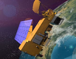
NASA, on behalf of the National Oceanic and Atmospheric Administration (NOAA), has awarded a sole source contract to ITT Corporation of Ft. Wayne, Ind. The award is for the Cross-track Infrared Sounder (CrIS) instrument planned for flight on the first Joint Polar Satellite System (JPSS-1) in 2014. JPSS is the restructured civilian portion of the National Polar-orbiting Operational Environmental Satellite System (NPOESS). This includes the satellites and sensors supporting civil weather and climate measurements and a shared ground infrastructure with the Department of Defense weather satellite system.
NASA is the procurement agent for these assets, and the agency's Goddard Space Flight Center in Greenbelt, Md., is the lead for acquisition for the program. This is a cost-reimbursement contract of approximately $98.6 million, with a period of performance through September 2014. Under this contract, ITT will manufacture, test and deliver the CrIS, support instrument integration on JPSS-1, and provide launch and post-launch support. The instrument will be identical to the CrIS planned for flight on the NPOESS Preparatory Project mission.
CrIS is the first in a series of advanced operational instruments that will provide detailed atmospheric temperature and moisture observations for weather and climate applications. This high-spectral resolution infrared instrument will measure atmospheric temperatures, water vapor and trace gases. Forecasters use the data in computer models to improve global and regional predictions of weather patterns, storm tracks and precipitation. This information will significantly improve climate prediction and short- and long-term weather forecasting.


