Showing posts with label Nasa Satellites. Show all posts

Proposed Mission to Jupiter System Achieves Milestone

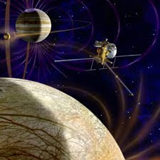
http://nasa-satellites.blogspot.com/With input from scientists around the world, American and European scientists working on the potential next new mission to the Jupiter system have articulated their joint vision for the Europa Jupiter System Mission. The mission is a proposed partnership between NASA and the European Space Agency. The scientists on the joint NASA-ESA definition team agreed that the overarching science theme for the Europa Jupiter System Mission will be "the emergence of habitable worlds around gas giants." The proposed Europa Jupiter System Mission would provide orbiters around two of Jupiter's moons: a NASA orbiter around Europa called the Jupiter Europa Orbiter, and an ESA orbiter around Ganymede called the Jupiter Ganymede Orbiter.

"We've reached hands across the Atlantic to define a mission to Jupiter's water worlds," said Bob Pappalardo, the pre-project scientist for the proposed Jupiter Europa Orbiter, who is based at NASA's Jet Propulsion Laboratory in Pasadena, Calif. "The Europa Jupiter System Mission will create a leap in scientific knowledge about the moons of Jupiter and their potential to harbor life." The new reports integrate goals that were being separately developed by NASA and ESA working groups into one unified strategy. The ESA report is being presented to the European public and science community this week, and the NASA report was published online in December.

The proposed mission singles out the icy moons Europa and Ganymede as special worlds that can lead to a broader understanding of the Jovian system and of the possibility of life in our solar system and beyond. They are natural laboratories for analyzing the nature, evolution and potential habitability of icy worlds, because they are believed to present two different kinds of sub-surface oceans. The Jupiter Europa Orbiter would characterize the relatively thin ice shell above Europa's ocean, the extent of that ocean, the materials composing its internal layers, and the way surface features such as ridges and "freckles" formed. It will also identify candidate sites for potential future landers. 
Average Class Space Missions Face Rocket Launch Concerns, Report Says

http://nasa-satellites.blogspot.com/
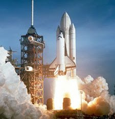
The next generation of NASA remote sensing satellites and space science probe could be loaded by rising launch expenses and delays as the agency incorporate new medium lift rockets, according to a Government responsibility Office report released Monday. The doubt surrounds 12 to 14 science missions through 2020 that have not yet received launch vehicle assignments, the government watchdog report said. NASA is finishing its use of the Delta 2 rocket, a workhorse launcher that has deliver almost 60 percent of the agency's scientific satellites to space since 1998. NASA is shifting future average class missions to SpaceX's Falcon 9 rocket and the Taurus 2 launcher being developed by Orbital Sciences Corp. The GAO found both vehicles supply the same market as the Delta 2 and have like costs.

But the Falcon 9 and Taurus 2 are not certified to launch NASA's most costly and important science missions. United Launch Alliance has three more NASA missions on its Delta 2 obvious. Parts for producing five more Delta 2 rockets are also accessible, but there are high costs of alter and maintaining launch pads to host any additional flights, according to the GAO. The report addressed NASA's efforts to support the enduring Delta 2 flights and the agency's medium class launch plan. "NASA is taking an suitable approach to help ensure the success of the remaining Delta 2 missions by sufficiently addressing workforce, support, and launch infrastructure risks," the details said. "Nevertheless, an reasonable and reliable medium launch capability is dangerous to NASA meeting its scientific goals."

Most of the medium class missions in NASA's portfolio are Earth scrutiny satellites, which need polar orbit launches from West Coast sites at Vandenberg Air Force Base, Calif., or Kodiak Launch multifaceted in Alaska. Neither company has an ready West Coast launch site. SpaceX plans to construct a Falcon 9 start pad at Vandenberg, and Orbital is still evaluating potential sites for polar Taurus 2 missions. The first NASA decision point is predictable in the next few months. NASA must choose on a launch vehicle for three Earth observation satellites in 2011. The missions are owing for liftoff in 2014 and 2015. NASA is predictable to settle on a rocket for the Soil Moisture Active and Passive, or SMAP, satellite by March. Other civil space missions planned for launch by 2015 and still lacking a launch vehicle assignment include the ice-mapping ICESat 2 spacecraft and the first member of NOAA's restore polar orbiting weather satellite fleet.

NASA Images Show Anatomy of Pakistan Flood Disaster

http://nasa-satellites.blogspot.com/In late July 2010, flooding caused by heavy monsoon rains began across several regions of Pakistan. According to the Associated Press, the floods have affected about one-fifth of this country of more than 170 million. Tens of thousands of villages have been flooded, more than 1,500 people have been killed, and millions have been left homeless. The floodwaters are not expected to recede fully before late August. NASA's CloudSat satellite captured the genesis of the flooding event as it flew over the region on July 28, 2010. At that time, a large area of intense thunderstorms covered much of Pakistan. Between July 28 and 29, up to 400 millimeters (16 inches) of rain fell from these storm cells, triggering flooding along the Indus and Kabul Rivers.

Storms with similar structures to this one have become common this summer as tropical monsoon moisture, coupled with a strengthening La Nina, dominate this region's weather patterns. The top portion of the second image, from the Moderate Resolution Imaging Spectroradiometer (MODIS) instrument on NASA's Aqua spacecraft, reveals the bright white cloud tops of the cluster of thunderstorms. The blue vertical line shows CloudSat's path at the time the MODIS image was acquired. CloudSat's path cut through a large thunderstorm cell in the northern section of the country. The Cloudsat data are shown in the bottom portion of the first image. As seen in the top half of the bottom image, CloudSat classified the majority of the clouds present at the time as deep convective (cumulonimbus) clouds, typical of thunderstorms.

The bottom half of the lower image shows the 3-D vertical structure of the storm along the satellite's flight path, revealing its heavy precipitation. CloudSat measured the cloud heights along the radar's flight path at around 15 kilometers (9.3 miles) in the areas of deepest convection. The next pair of images was taken by the vertical-viewing camera on the Multi-angle Imaging Spectroradiometer (MISR) instrument aboard NASA's Terra spacecraft. The image on the left was taken Aug. 8, 2009, while the one on the right is from Aug. 11, 2010. These false-color views display the instrument's near-infrared, red and green bands as shades of red, green and blue. The colors distinctly highlight the contrast between water and vegetation on the river banks, since vegetation appears bright in the near-infrared portion of the electromagnetic spectrum.

Drought Drives Decade-Long Decline in Plant Growth

http://nasa-satellites.blogspot.com/
Global plant productivity that once was on the rise with warming temperatures and a lengthened growing season is now on the decline because of regional drought according to a new study of NASA satellite data. Plant productivity is a measure of the rate of the photosynthesis process that green plants use to convert solar energy, carbon dioxide and water to sugar, oxygen and eventually plant tissue. Compared with a 6 percent increase in plant productivity during the 1980s and 1990s, the decline observed over the last decade is only 1 percent. The shift, however, could impact food security, biofuels and the global carbon cycle.

Researchers Maosheng Zhao and Steven Running of the University of Montana in Missoula discovered the global shift from an analysis of NASA satellite data. The discovery comes from an analysis of plant productivity data from the Moderate Resolution Imaging Spectroradiometer on NASA's Terra satellite, combined with other growing season climate data, including temperature, solar radiation and water. "We see this as a bit of a surprise, and potentially significant on a policy level because previous interpretations suggested global warming might actually help plant growth around the world," Running said.

Previous research found land plant productivity was on the rise. A 2003 paper in the journal Science led by scientist Ramakrishna Nemani, now a researcher at NASA's Ames Research Center in Moffett Field, Calif., showed the 6 percent increase in global terrestrial plant productivity between 1982 and 1999. The increase was traced to nearly two decades of temperature, solar radiation and water availability conditions, influenced by climate change, that were favorable for plant growth. Setting out to update that analysis, Zhao and Running expected to see similar results as global average temperatures continued to climb.

Cutting Into Arctic Sea Ice

http://nasa-satellites.blogspot.com/
"Over by the fish, below the soccer field," said ice scientist Bonnie Light, pointing at the Arctic sea ice from the bridge of the U.S. Coast Guard Cutter Healy earlier this month during NASA's ICESCAPE oceanographic mission. Light, of University of Washington, and other ice scientists crowd around the windows on the bridge of the Healy describing shapes created by the melt ponds on the surface of the Arctic sea ice. They point out everything from unicorns to Volkswagons. But the imaginative morning ritual is serious business; the ice teams are discussing where on the ice to work and planning the logistics of the day’s field work.

Since 1979, satellites have tracked changes to Arctic sea ice extent, showing dramatic declines. On average the ice is losing about 13 percent of its summer coverage each decade and the record low was set in 2007. The decline raises two key questions: Why are these changes happening and what do they mean for Arctic ecosystems, particularly the ocean-dwelling plants phytoplankton that play an integral role in Earth's carbon cycle? Exploring those questions since last month is the ICESCAPE mission onboard the Healy, which is studying the physics, chemistry and biology of the ocean and sea ice within a changing Arctic.

On 12 days scattered throughout the five-week mission, the Healy "parked" amid an ice floe and teams of ice scientists stepped foot on the floating ice for a close up look. After agreeing on a plan from the bridge, ice scientists on July 9, 2010, readied for work at ice station 10 in the Chukchi Sea. The ship's crane lowered sleds of scientific equipment over the side of the ship and then scientists descended down a steep ramp to the ice where they dispersed and set up equipment.

First Map Of Global Forest Heights Created From NASA Data

http://nasa-satellites.blogspot.com/
Scientists have produced a first-of-its kind map of the height of the world's forests by combining data from three NASA satellites. The map will help scientists build an inventory of how much carbon the world's forests store and how fast that carbon cycles through ecosystems and back into the atmosphere. Maps of local and regional forest canopy have been produced before, but the new map is the first that spans the entire globe using one uniform method. The map was based on data collected by NASA's Terra and Aqua satellites, along with the Ice, Cloud and land Elevation Satellite, or ICESat.

Michael Lefsky, a remote-sensing specialist from Colorado State University in Ft. Collins, produced the final product. Lefsky describes his results in a journal paper to be published next month in Geophysical Research Letters. The new map shows the world's tallest forests are clustered in North America's Pacific Northwest and portions of Southeast Asia. Shorter forests are found in broad swaths across northern Canada and Eurasia. The primary data Lefsky used was from a laser technology called lidar on the ICESat.

Lidar can capture vertical slices of forest canopy height by shooting pulses of light at the ground and observing how much longer it takes for light to bounce back from the surface than from the top of the forest canopy. Since lidar can penetrate the top layer of forest canopy, it provides a detailed snapshot of the vertical structure of a forest. "Lidar is unparalleled for this type of measurement," Lefsky said. "It would have taken weeks or more to collect the same amount of data in the field by counting and measuring tree trunks that lidar can capture in seconds."

NASA To Fly Into Hurricane Research This Summer

http://nasa-satellites.blogspot.com/
Three NASA aircraft will begin flights to study tropical cyclones on Aug. 15 during the agency's first major U.S.-based hurricane field campaign since 2001. The Genesis and Rapid Intensification Processes mission, or GRIP, will study the creation and rapid intensification of hurricanes. One of the major challenges in tropical cyclone forecasting is knowing when a tropical cyclone is going to form. Scientists will use the data from this six-week field mission to better understand how tropical storms form and develop into major hurricanes.

Mission scientists will also be looking at how storms strengthen, weaken and die. "This is really going to be a game-changing hurricane experiment," said Ramesh Kakar, GRIP program scientist at NASA Headquarters in Washington. "For the first time, scientists will be able to study these storms and the conditions that produce them for up to 20 hours straight. GRIP will provide a sustained, continuous look at hurricane behavior at critical times during their formation and evolution."

GRIP is being led by Kakar and three project scientists: Scott Braun and Gerry Heymsfield of NASA's Goddard Space Flight Center in Greenbelt, Md., and Edward Zipser of the University of Utah in Salt Lake City. Three NASA satellites will play a key role in supplying data about tropical cyclones during the field mission. The Tropical Rainfall Measuring Mission, or TRMM, managed by both NASA and the Japan Aerospace Exploration Agency, will provide rainfall estimates and help pinpoint the locations of "hot towers" or powerhouse thunderstorms in tropical cyclones.

NASA's history had changed and got recognized after the launch of Sputnik


Nasa’s history had changed on 4th October, 1957, the Soviet Union had successfully launched Sputnik I. The world's first artificial satellite was about the size of a beach ball i.e. 58 cm.or 22.8 inches in diameter, weighed only 83.6 kg. or 183.9 pounds, and took about 98 minutes to orbit the Earth on its elliptical path. That launch ushered in latest political, military, technological, and scientific developments. While the Sputnik launch was a single event, it manifests the start of the space age and the U.S.-U.S.S.R space race.


Launch of Sputnik had changed everything as a technical achievement; Sputnik caught the world's attention and the American public off-guard. Its size was more impressive than Vanguard's intended 3.5-pound payload and in addition, the public feared that the Soviets' ability to launch satellites also translated into the capability to launch ballistic missiles that could carry nuclear weapons from Europe to the U.S. Then the Soviets strike again; on November 3, Sputnik II was launched, carrying a much heavier payload, including a dog named Laika.


Immediately after the Sputnik I launch in October, the U.S. Defense Department responded to the political furor by approving financial support for another U.S. satellite project. As a simultaneous alternative to Vanguard, Wernher von Braun and his Army Redstone Arsenal group began work on the Explorer project.


On 31st January, 1958, the tide altered, when the United States successfully launched Explorer I. This satellite carried a small scientific payload that finally discovered the magnetic radiation belts around the Earth, named after principal investigator James Van Allen. The Explorer program continued as a successful constant series of lightweight, scientifically useful spacecraft.


The Sputnik launch also led straight to the creation of National Aeronautics and Space Administration (NASA). In July 1958, Congress approved the National Aeronautics and Space Act, which created NASA as of October 1, 1958 from the National Advisory Committee for Aeronautics (NACA) and other government agencies.

APOLLO 11 -- The Lunar Reflectors

Main Objective of the Mission:

In 1969, Apollo 11 astronauts Neil Armstrong and Buzz Aldrin deployed a range of scientific experiments in the fine powder of the Sea of Tranquility. Among those devices was a laser ranging retroreflector, later a generation, it is still yielding fundamental scientific data.

Scientists who analyze information from the Lunar Laser Ranging Experiment have reported some watershed results from these long-term experiments, said team investigator Dr. Jean Dickey at NASA's Jet Propulsion Laboratory, California.

Laser ranging has made a possible wealth of new information about the dynamics and structure of the Moon. Among all new observations, scientists now believe that the Moon may harbor a liquid core. The theory has been proposed from information on the Moon's rate of rotation and very slight bobbing motions caused by gravitational forces from the Sun and Earth.

Investigators at JPL (J. Williams, et. al.) have computed that lunar ephemeredes and coordinates of the lunar reflectors in two systems, principal axes and mean earth rotation axes. More information about this analysis can be found in the publications listed below.

Mission Instrumentation:

The instrumentation on the moon related to laser ranging is the five retro-reflectors arrays (three US, two French/Russian).

The Apollo Lunar Surface Journal is an evidence of the lunar surface operations conducted by the six pairs of astronauts who landed on the Moon from 1969 through 1972. The Journal is intended as a resource for everyone wanting to know what happened during the missions and why. This includes a corrected transcript of all recorded conversations between the lunar surface crews and Houston. The Journal in addition contains extensive, interwoven commentary by the Editor and by ten of the twelve moon walking astronauts.

The Apollo Lunar Surface Journal was motivated by the work of New Zealand historian J.C. Beaglehole, the 20th Century's foremost authority on the European exploration of the Pacific and, particularly, on the voyages of Captain James Cook.

Goal of AJISAI Satellite

Main Objectives of Ajisai Satellite:

Ajisai is Japanese for Hydrangea which is prior to launch, the satellite was called Experimental Geodetic Satellite (EGS). The Ajisai mission has two main objectives.
  • The first objective, which was small term, was testing of NASDA'S (now JAXA) H-I, two-stage, launch vehicle.

  • The second and main long term objective was to determine the exact positions of the many isolated Japanese Islands. Ajisai satellites can also be used for directional and photometric observations, using the mirrors equipped on the surface of satellite.

Mission Instrumentation onboard:

  • Mirrors (318)

  • Retro reflector array


Final shots taken by KAGUYA'S HDTV, TC and added cameras


JAXA released ultimate still images taken by the High Definition Television (HDTV) of the lunar explorer "KAGUYA," which was maneuvered to be dropped onto the Moon's surface on June 11.

It’s also provided a 3D movie compiled based on observation data captured by the Terrain Camera (TC) about 12 minutes prior to its landing on the Moon, and the last observation data of the Multi-band Imager during the second last revolution ahda of the last one before hitting the Moon.

It’s also planed to hold a public event "Fly me to the Moon in AKIBA" to commemorate the completion of the KAGUYA mission in Akihabara on July 18 and 19. Please come and join us.