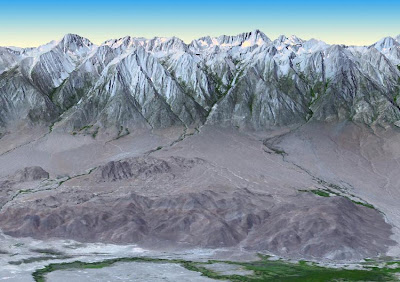
NASA and Japan released a significantly improved version of the most complete digital topographic map of Earth on Monday, produced with detailed measurements from NASA's Terra spacecraft.
The map, known as a global digital elevation model, was created from images collected by the Japanese Advanced Spaceborne Thermal Emission and Reflection Radiometer, or ASTER, instrument aboard Terra. So-called stereo-pair images are produced by merging two slightly offset two-dimensional images to create the three-dimensional effect of depth. The first version of the map was released by NASA and Japan's Ministry of Economy, Trade and Industry (METI) in June 2009.
"The ASTER global digital elevation model was already the most complete, consistent global topographic map in the world," said Woody Turner, ASTER program scientist at NASA Headquarters in Washington. "With these enhancements, its resolution is in many respects comparable to the U.S. data from NASA's Shuttle Radar Topography Mission, while covering more of the globe."

No comments:
Post a Comment